SAR Fundamentals/Navigation/Map/Features
From PCSAR
(→Aids) |
(→Aids) |
||
| (9 intermediate revisions not shown.) | |||
| Line 41: | Line 41: | ||
{{lesson slides start}} | {{lesson slides start}} | ||
| - | {{lesson slide|00:00| | + | {{lesson slide|00:00|7 min}} |
Introduce topic title | Introduce topic title | ||
| Line 47: | Line 47: | ||
Present Objectives | Present Objectives | ||
| - | |||
| - | |||
| - | |||
| - | |||
| - | |||
| - | |||
{{lesson slide||}} | {{lesson slide||}} | ||
| + | [[Image:Example Roadmap1.jpg|right|400px]] | ||
| + | [[Image:Members:Example Shading Relief Map.jpg|right|400px]] | ||
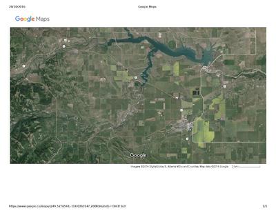
| + | [[Image:Example Google Maps Pincher Creek area.pdf|right|400px]] | ||
Types of maps: | Types of maps: | ||
* road map | * road map | ||
| Line 62: | Line 59: | ||
** shows the terrain | ** shows the terrain | ||
** good for navigating back country | ** good for navigating back country | ||
| + | * shadded relief map | ||
| + | * marine map | ||
| + | * camping | ||
| + | * layers | ||
| + | * google | ||
| + | |||
| + | Q: If you don't know what a symbol means, how can you find? Legend | ||
| + | {{lesson slide|00:03|}} | ||
| + | Material | ||
| + | * ''distribute maps'' | ||
| + | * keeping maps reusable | ||
| + | * types of pencils that are map safe | ||
| + | * types of erasers that are map safe | ||
{{lesson slide||}} | {{lesson slide||}} | ||
| Line 73: | Line 83: | ||
Using as a road map | Using as a road map | ||
* N on the top | * N on the top | ||
| + | * North indicator - legend | ||
* recognize roads, buildings, railways | * recognize roads, buildings, railways | ||
* symbol key on back | * symbol key on back | ||
| Line 92: | Line 103: | ||
* 82H/5 for each pair of students | * 82H/5 for each pair of students | ||
| + | * Download map from [[Navigation#Maps|Federal website]] for computer projection | ||
* plenty of table space | * plenty of table space | ||
* overhead projector | * overhead projector | ||
* screen | * screen | ||
| - | * slides | + | * {{link|Image:Map Features slides.pdf}} |
| + | * [[Maps#Topo maps|topo maps]] 82 G/8 | ||
* a compass for each pair of students | * a compass for each pair of students | ||
| + | |||
| + | |||
* {{link|Members:SAR Fundamentals/Restricted/Ralph Eckman 2013-01}} | * {{link|Members:SAR Fundamentals/Restricted/Ralph Eckman 2013-01}} | ||
* {{link|Image:Members:Nav Map Features.pdf}} | * {{link|Image:Members:Nav Map Features.pdf}} | ||
| + | * [[Training/Ideas/Map Features]] | ||
== Question bank == | == Question bank == | ||
Current revision
Contents |
[edit] Subject
What is this lesson plan about?
Major land features on a topo map
[edit] Authors
List who wrote this lesson plan.
Brett Wuth
[edit] Scope
What is included in this lesson, what's not and why.
This lesson is an introduction to Navigation for SAR Fundamentals students.
It is part of a larger 8 hour series of lessons.
- SAR Fundamentals Manual: Ch.13 "Navigation"
- Basic SAR Skills Manual: Ch.7 "Navigation"
[edit] Prerequisites
What should students already know/have accomplished before the lesson is presented.
[edit] Objectives
At the conclusion of this lesson the participants will be able to identify:
- the type of a map
- the indicated scale of a map
- the 4 cardinal directions on a map
- be able to recognize roads, railways, building and common symbols
- be able to identify water ways and water bodies
- be able to indicate direction of water flow based on the shape of confluences, islands, and stream sizes
- recognize forrested and unforrested land
for a topo map, identify:
- the name and number
- the neighboring maps
[edit] Time Plan
Total Time: 15 minutes
Ask students to hand draw map of how to get to classroom from another city
Prizes (notepads). North Arrow, Scale, Highway #'s, Landmarks.
| Time | Material
|
|
00:00 7 min |
Introduce topic title Introduce Instructor Present Objectives |
|
|
   Types of maps:
Q: If you don't know what a symbol means, how can you find? Legend |
|
00:03
|
Material
|
|
|
|
|
|
Using as a road map
|
|
|
|
|
|
|
[edit] Aids
What materials are needed or useful in presenting this lesson.
- 82H/5 for each pair of students
- Download map from Federal website for computer projection
- plenty of table space
- overhead projector
- screen
- Image:Map Features slides.pdf
- topo maps 82 G/8
- a compass for each pair of students
[edit] Question bank
List of questions suitable for an review/exam of this section.
See Question bank
[edit] Frequently Asked Questions
What are some of the questions that students typically ask. Include the answers.
[edit] Feedback
When has this lesson been presented. What was the feedback.
[edit] License
What can others do with this lesson?
Copyright (c) 2011-2013, Brett Wuth.
This work is licensed under a Creative Commons Attribution-NonCommercial 2.5 Canada License. To view a copy of this license, visit http://creativecommons.org/licenses/by-nc/2.5/ca/ or send a letter to Creative Commons, 559 Nathan Abbott Way, Stanford, California 94305, USA.
[edit] Reference Material
If you need to cite sources, do so here.
[1]
[edit] Notes
Any additional notes, etc.
[edit] To Do
(review: Brett Wuth)
- buy more topo maps

